Send an E-Postcard of:
"Orange"
(c) Pocumtuck Valley Memorial Association, Deerfield MA. All rights reserved.
Contact us for information about using this image.
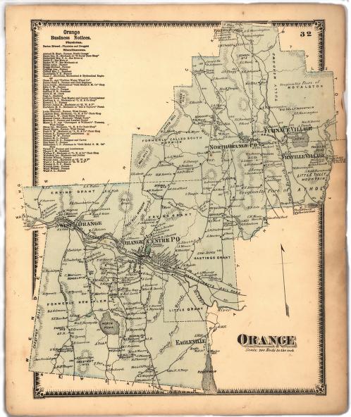
The 1871 map of Orange, Massachusetts, shows the dramatic changes that had happened to the town in the preceding twenty years. In the 1830s, Orange was a remote rural site, but in the 1850s and 1860s a number of manufacturing companies were drawn to the town by the presence of water power from the Millers River and the Vermont & Massachusetts Railroad. Orange grew rapidly, becoming by the 1890s the third largest town in Franklin County. The presence of industry in Orange center drew other industries and factories began in places like Eagleville, in the town's southeastern corner, or in Fryville, on its northeastern half. The prosperity of Orange is also evident in the large, relatively closely spaced homes radiating out from the center of town: many of these were the large houses of village industrialists.
top of page
|
|


