Send an E-Postcard of:
Shelburne Falls, Mass Birds-Eye View
(c) Pocumtuck Valley Memorial Association, Deerfield MA. All rights reserved.
Contact us for information about using this image.
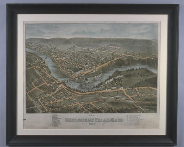
Because they picture a location as seen from above, aerial views such as this were commonly known as birds-eye views. This lithograph of Shelburne Falls, Massachusetts, shows the impact of the industrial revolution on a small, agricultural community. Numerous factories and mills cluster along the Deerfield River within close proximity to the railroad. The Lamson Goodnow cutlery works, the town's largest manufacturer, dominates the landscape in the foreground. What appears to be a natural waterfall is actually a dam built in 1859 at the head of rapids in the river. Note the proximity of open farm land to the land assigned for industrial use - a mixed landscape. At the bottom of the lithograph a key lists the town's most important man-made assets: schools, churches, hotels, civic buildings and factories.
top of page
|
|


