


Advanced Search
| Online Collection |
|
||||||||||||||||||||||
|
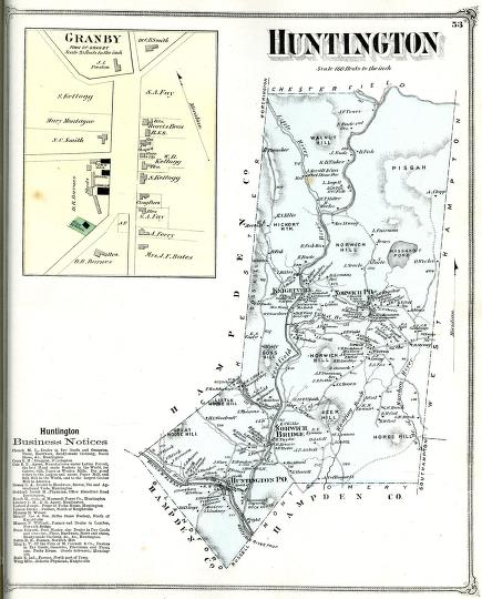
There is currently no available "Beginner" label. The following is the default level label: These two maps appear in an atlas of Hampshire County, Massachusetts, published by FW Beers and Co. The Beers maps of this time period are informative because the show and label nearly every building in town. The map of Granby is actually of the town center only. It is a typical New England town center with a town hall, school and Congregational church. The entire town of Huntington, in the western part of Hampshire County, is shown here. Incorporated as a town in 1855, Huntington included two branches of the Westfield River and the Boston and Albany Railroad. As in many New England towns in the nineteenth century, the combination of rivers and railroads promoted industrial development. A close look at the map reveals a number of factory buildings.
|
Granby and Huntington
|


| |
Home | Online Collection | Things
To Do | Turns
Exhibit | Classroom | Chronologies | My
Collection
About This Site | Site Index | Site Search | Feedback