icon for Home page
icon for Kid's Home page
icon for Digital Collection
icon for Activities
icon for Turns Exhibit
icon for In the Classroom
icon for Chronologies
icon for My Collection

Online Collection
Select a page:

document
(c) Pocumtuck Valley Memorial Association, Deerfield MA. All rights reserved.
Contact us for information about using this image.


label levels:

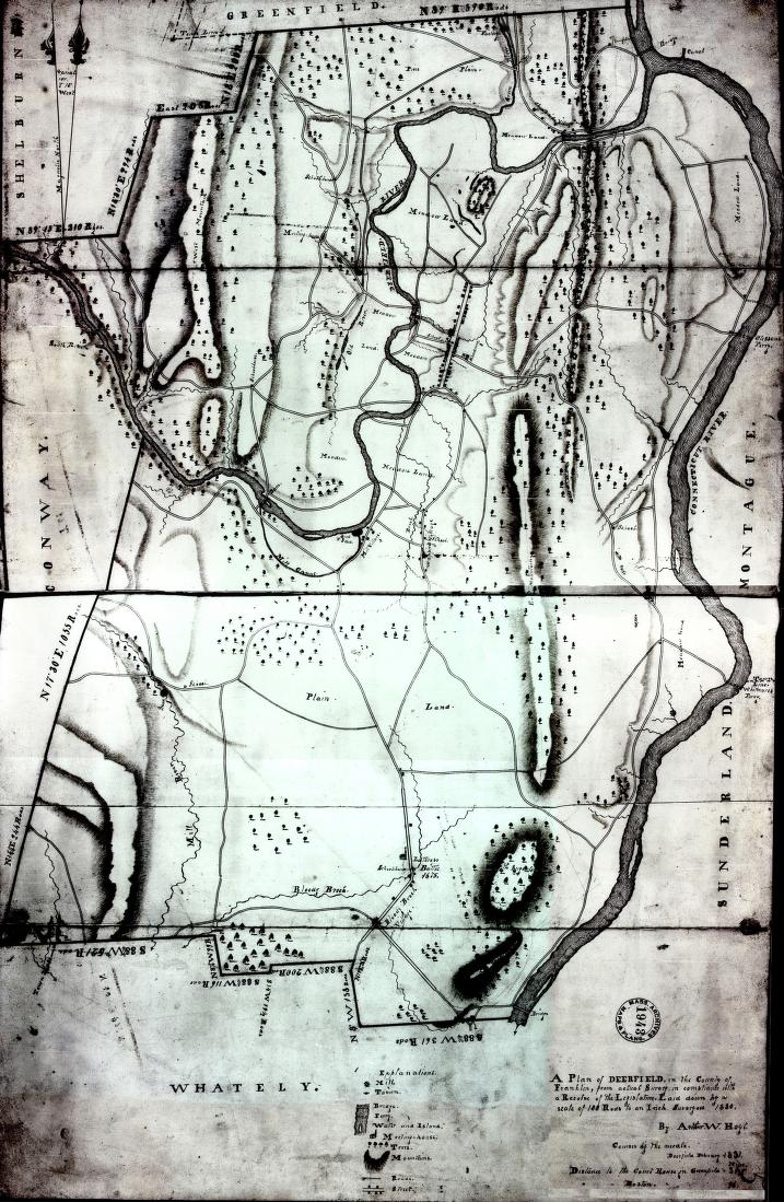
Arthur W. Hoyt's finely drawn plan that the state government asked him to make shows the growth of the town. The growth of the communities of Mill Village, Wapping Village, Bloody Brook Village (now called South Deerfield), and Cheapside Village shows the growth of the town's population outside of the first settlement of Deerfield. More roads, the building of bridges to replace ferries, and a bigger number of schools, academies, and meetinghouses shows more services for town people.


top of page

"Plan of Deerfield in the County of Franklin from Actual Survey"

cartographer   Arthur Wellesley Hoyt (1811-1899)
date   1831
location   Deerfield, Massachusetts
height   32.5"
width   21.0"
process/materials   manuscript, paper, ink
item type   Maps/Cadastral
accession #   #L98.006


Look Closer icon My Collection icon Detailed info icon


ecard icon Send an e-Postcard of this object


See Also...

"Geographical, Statistical & Historical View of the Town of Deerfield"

"History of the Connecticut Valley in Massachusetts"

Deerfield Panorama


button for Side by Side Viewingbutton for Glossarybutton for Printing Helpbutton for How to Read Old Documents


Home | Online Collection | Things To Do | Turns Exhibit | Classroom | Chronologies | My Collection
About This Site | Site Index | Site Search | Feedback