


Advanced Search
| Online Collection |
|
|||||||||||||||||||||
|
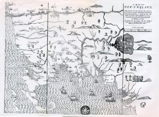
This map, the first printed in England's American colonies, shows the land affected by King Philip's War (1675-1676). Oriented with west at the top, this Map of New-England shows the pattern of colonial settlement moving from the Atlantic coast inland to the Connecticut River valley. Tribal names ("Nipmuck") and locations ("Mount-hope," Philip's village) show that Native Americans were in the area. Numbers on the map show villages that were attacked during the war.
|
"Map of New-England"
|


| |
Home | Online Collection | Things
To Do | Turns
Exhibit | Classroom | Chronologies | My
Collection
About This Site | Site Index | Site Search | Feedback